


Britain and Ireland Garmin topographic map
$42
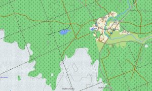
Britain and Ireland topo map for Garmin
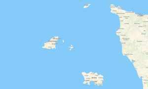
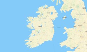
Explore Britain and Ireland with one unified Garmin maps product designed for reliable offline navigation across England, Scotland, Wales, Northern Ireland, and the Republic of Ireland. This detailed Garmin GPS map covers major cities, rural lanes, coastal roads, islands, mountain regions, national parks, ferry routes, and historic travel corridors throughout both islands.
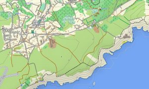
Created as a practical OSM map tourist Garmin solution, the map is ideal for road trips, hiking holidays, cycling tours, campervan journeys, motorcycle routes, and cultural travel. These outdoor maps Garmin users rely on include roads, public paths, rivers, lakes, forests, coastlines, villages, viewpoints, and essential tourist infrastructure for confident independent exploration.
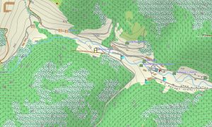
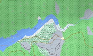
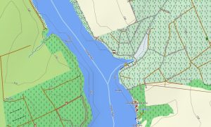
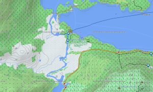
This Garmin GPS map functions as a detailed OSM topo map, showing elevation contours, hills, mountains, cliffs, moors, valleys, beaches, islands, canals, reservoirs, and rural tracks. The Garmin map is especially useful in the Scottish Highlands, Lake District, Snowdonia, Peak District, Yorkshire Dales, Wicklow Mountains, Kerry, Connemara, Donegal, and along the Wild Atlantic Way.
Based on open street maps Garmin compatible data, the product combines rich local detail with practical topographic information for both urban and remote environments. After purchase, users can quickly download Garmin map files and install them on compatible devices. Regular Garmin OSM maps updates help keep road data, walking paths, ferry connections, and points of interest accurate over time.
Maps for Garmin navigator devices support long-distance driving, countryside touring, ferry access, city navigation, and route planning between castles, beaches, trailheads, national parks, harbors, and historic towns. A map for Garmin watch is convenient for hikers, runners, cyclists, walkers, and outdoor travelers who need route guidance directly on the wrist.
The unified Britain and Ireland Garmin map is a practical choice for travelers who want one seamless navigation solution instead of switching between separate regional products. With OSM topographic maps, offline GPS positioning, searchable locations, routable roads, and terrain awareness, these topographic maps for Garmin provide dependable support for every journey across the British Isles and Ireland.
Key Features:
- Topographic maps for Garmin covering Britain and Ireland include roads, rural lanes, footpaths, cycleways, rivers, lakes, canals, forests, coastlines, islands, and elevation contours
- Natural features include the Scottish Highlands, Snowdonia, Lake District, Peak District, Wicklow Mountains, Atlantic cliffs, Irish lakes, moorlands, beaches, valleys, and island landscapes
- Road coverage includes motorways, A-roads, B-roads, regional roads, city streets, country lanes, bridges, tunnels, ferry approaches, and scenic coastal routes
- Points of interest include castles, cathedrals, museums, historic towns, lighthouses, harbors, viewpoints, campsites, beaches, monuments, trailheads, and national parks
- Routing support helps compatible maps for Garmin navigator devices guide drivers, cyclists, and travelers through cities, countryside, ferry routes, and long-distance touring corridors
- Full compatibility is available for many handheld Garmin GPS units, automotive navigators, outdoor devices, cycling computers, and supported models using a map for Garmin watch with OSM topographic maps
Only logged in customers who have purchased this product may leave a review.
Reviews
There are no reviews yet.