


Estonia Garmin topographic map
$29
Estonia topo map for Garmin
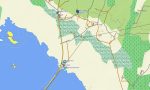
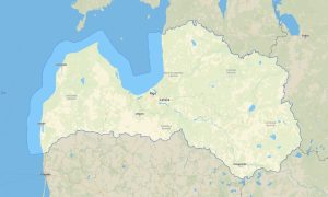
Explore Estonia’s forests, bogs, Baltic coastline, medieval towns, islands, and quiet rural roads with reliable Garmin maps for offline navigation. This Garmin GPS map provides coverage for Tallinn, Tartu, Pärnu, Narva, Saaremaa, Hiiumaa, national parks, lake districts, and remote countryside routes.
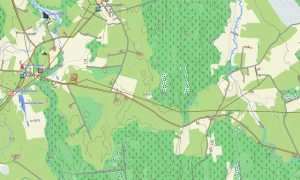
Developed as an OSM map tourist Garmin resource, the map is suitable for self-drive travel, bicycle touring, hiking, nature photography, coastal trips, and cultural exploration. These outdoor maps Garmin travelers use include forest paths, local roads, wetlands, rivers, villages, ferry terminals, and tourist landmarks.
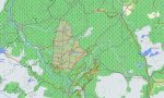
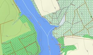
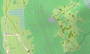
This Garmin GPS map functions as an OSM topo map with elevation contours, lakes, bog areas, coastline, trails, woodland roads, and settlement details. The Garmin map is particularly useful in Lahemaa National Park, Soomaa wetlands, island interiors, and rural regions where offline guidance is important.
Using open street maps Garmin compatible data, the map offers practical navigation detail for both urban and natural environments. An instant download Garmin map link allows fast installation, while updated Garmin OSM maps help keep routes, roads, and local points of interest current.
Maps for Garmin navigator devices support road trips across Estonia, ferry-connected island routes, countryside driving, and cross-border travel. A map for Garmin watch is convenient for hikers, trail runners, cyclists, and travelers following forest paths, city routes, or coastal tracks.
Key Features:
- Topographic maps for Garmin covering Estonia include roads, forest tracks, paths, rivers, lakes, bogs, coastlines, islands, settlements, and elevation contours
- Natural features include Baltic beaches, peat bogs, pine forests, Lake Peipus, limestone cliffs, wetlands, islands, rivers, and protected nature reserves
- Road coverage includes national highways, regional roads, city streets, village lanes, forest roads, ferry connections, and border routes
- Points of interest include medieval centers, castles, manor houses, lighthouses, harbors, museums, campsites, viewpoints, nature trails, and national parks
- Routing support allows compatible maps for Garmin navigator devices to assist with city travel, island navigation, and rural journeys
- Full compatibility is available for handheld Garmin GPS units, automotive devices, outdoor navigators, and supported models using a map for Garmin watch with OSM topographic maps
Only logged in customers who have purchased this product may leave a review.


Reviews
There are no reviews yet.