


Andorra Garmin topographic map
$22
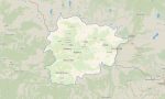
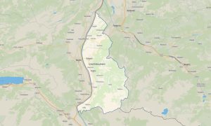
Andorra topo Map for Garmin
Navigate Andorra’s high mountain terrain with precise Garmin maps designed for alpine roads, ski areas, hiking trails, cycling climbs, and compact urban routes. This Garmin GPS map provides detailed offline coverage of Andorra la Vella, Escaldes-Engordany, mountain villages, border crossings, valleys, and Pyrenean landscapes.
Created as an efficient OSM map tourist Garmin resource, the map is ideal for travelers exploring scenic passes, ski resorts, summer trekking areas, and cross-border routes between France and Spain. These outdoor maps Garmin adventurers use are especially valuable in steep terrain where elevation awareness is essential.
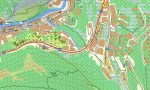
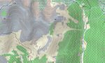
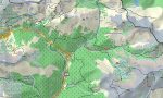
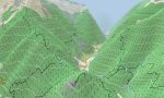
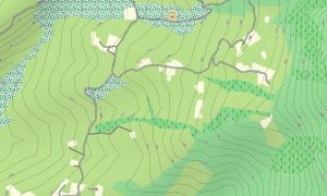
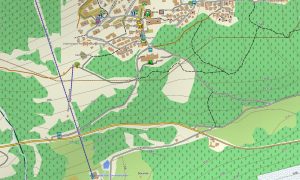
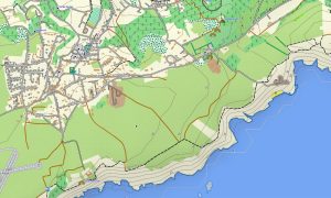
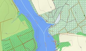
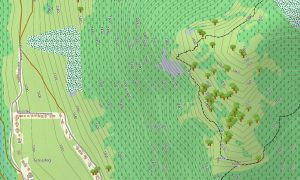
This Garmin GPS map works as a refined OSM topo map, showing contour lines, mountain ridges, rivers, forests, trails, ski infrastructure, access roads, and small settlements. The Garmin map helps users evaluate climbs, descents, valley routes, and route difficulty before starting outdoor activities.
Built from open street maps Garmin compatible data, the product delivers detailed local information in a compact but highly varied country. With an instant download Garmin map option, installation is fast and simple. Updated Garmin OSM maps help maintain reliable navigation for both urban streets and alpine environments.
Maps for Garmin navigator devices are useful for driving mountain roads, reaching ski stations, planning cycling tours, and navigating between parishes. A map for Garmin watch supports hikers, trail runners, cyclists, and winter-sport travelers who want quick route visibility directly on the wrist.
Key Features:
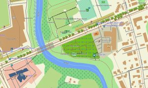
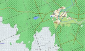
- Topographic maps for Garmin covering Andorra include roads, mountain tracks, hiking routes, ski areas, rivers, valleys, settlements, and elevation contours
- Natural features include the Pyrenees, glacial valleys, high passes, alpine meadows, forested slopes, rivers, lakes, and rugged mountain ridgelines
- Road coverage includes national roads, local parish streets, mountain access roads, border routes, resort roads, tunnels, and scenic driving sections
- Points of interest include ski resorts, viewpoints, churches, old villages, shopping districts, trailheads, shelters, lakes, passes, cycling climbs, and tourist services
- Routing support helps compatible maps for Garmin navigator devices provide practical directions through narrow valleys and mountain road networks
- Full compatibility supports handheld Garmin GPS units, automotive devices, cycling computers, and selected models using a map for Garmin watch with OSM topographic maps
Only logged in customers who have purchased this product may leave a review.


Reviews
There are no reviews yet.