


Iceland Garmin topographic map
$29
Iceland topo map for Garmin
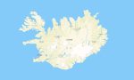
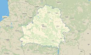
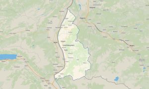
Navigate Iceland’s volcanic landscapes, glaciers, fjords, highland tracks, waterfalls, and remote coastal roads with specialized Garmin maps for offline use. This Garmin GPS map covers Reykjavík, Akureyri, the Ring Road, Westfjords, South Coast, Highlands, national parks, geothermal areas, and isolated settlements.
Created as a rugged OSM map tourist Garmin resource, the map supports 4×4 travel, hiking, photography trips, campervan routes, expedition planning, and wilderness navigation. These outdoor maps Garmin adventurers require include roads, F-roads, tracks, rivers, glaciers, trails, huts, and natural landmarks.
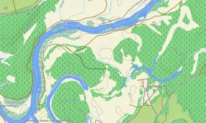
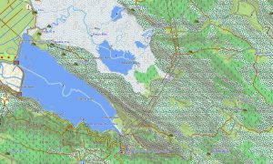
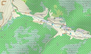
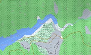
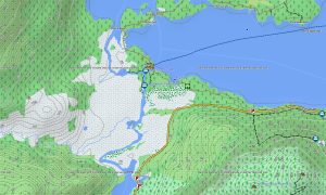
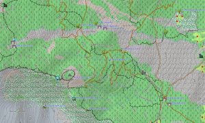
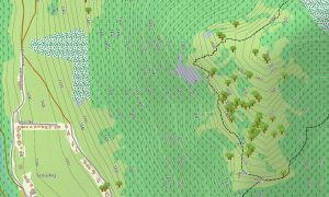
This Garmin GPS map functions as a detailed OSM topo map, displaying elevation contours, lava fields, mountain ridges, valleys, rivers, waterfalls, ice caps, and coastal features. The Garmin map is essential for understanding terrain in remote highland regions where weather, river crossings, and limited services demand preparation.
Built from open street maps Garmin compatible data, the product provides valuable detail for both populated areas and difficult wilderness routes. After purchase, users can download Garmin map files immediately, while Garmin OSM maps updates help improve roads, trails, and points of interest.
Maps for Garmin navigator devices are useful for Ring Road travel, highland access, camper routes, and navigation between natural attractions. A map for Garmin watch supports hikers, trail runners, and photographers exploring volcanic trails, glaciers viewpoints, and remote valleys.
Key Features:
- Topographic maps for Garmin covering Iceland include roads, F-roads, tracks, hiking trails, rivers, glaciers, lakes, coastlines, settlements, and elevation contours
- Natural features include volcanoes, lava fields, glaciers, fjords, waterfalls, geothermal zones, black-sand beaches, mountains, valleys, and highland deserts
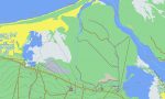
- Road coverage includes the Ring Road, regional roads, gravel roads, highland tracks, urban streets, rural access roads, bridges, and ferry approaches
- Points of interest include waterfalls, hot springs, campsites, huts, viewpoints, lighthouses, harbors, museums, national parks, volcanic sites, and historic farms
- Routing support helps compatible maps for Garmin navigator devices plan travel across main roads, gravel routes, and selected remote access corridors
- Full compatibility is available for handheld Garmin GPS units, automotive devices, outdoor navigators, and supported models using a map for Garmin watch with OSM topographic maps
Only logged in customers who have purchased this product may leave a review.

Reviews
There are no reviews yet.