


Cyprus Garmin topographic map
$29
Cyprus topo map for Garmin
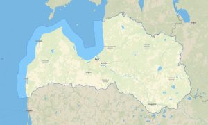
Navigate Cyprus with detailed Garmin maps covering Mediterranean beaches, Troodos mountain villages, archaeological sites, coastal cities, rural roads, and hiking routes. This Garmin GPS map provides offline guidance for Nicosia, Limassol, Larnaca, Paphos, Ayia Napa, the Akamas Peninsula, and mountain areas where reliable navigation is important.
Designed as a practical OSM map tourist Garmin solution, the map supports beach travel, cultural sightseeing, cycling routes, walking tours, rental-car journeys, and outdoor exploration. These outdoor maps Garmin users depend on include roads, tracks, paths, coastlines, rivers, viewpoints, heritage sites, and natural areas.
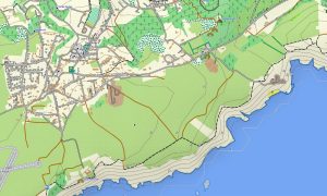
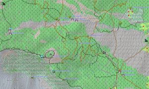
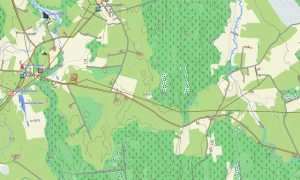
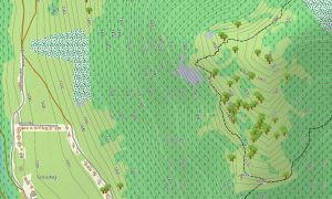
This Garmin GPS map functions as an OSM topo map, showing elevation contours, hill ranges, valleys, forest roads, trails, reservoirs, and coastal terrain. The Garmin map is especially useful in the Troodos Mountains and Akamas landscapes, where route planning benefits from accurate topographic information.
Based on open street maps Garmin compatible data, the product delivers detailed coverage for cities, villages, tourist zones, and rural interiors. After purchase, users can download Garmin map files instantly, while Garmin OSM maps updates help keep roads, paths, and places of interest current.
Maps for Garmin navigator devices are ideal for road trips, resort access, scenic drives, and navigation between beaches, archaeological parks, and mountain villages. A map for Garmin watch supports hikers, runners, cyclists, and travelers who need portable route guidance.
Key Features:
- Topographic maps for Garmin covering Cyprus include roads, tracks, footpaths, coastlines, rivers, reservoirs, villages, beaches, forests, and elevation contours
- Natural features include the Troodos Mountains, Akamas Peninsula, Mediterranean coastline, sea cliffs, pine forests, valleys, beaches, salt lakes, and dry riverbeds
- Road coverage includes motorways, city streets, village roads, mountain roads, coastal routes, rural tracks, resort access roads, and border-area connections
- Points of interest include archaeological sites, monasteries, castles, beaches, marinas, viewpoints, nature trails, campsites, museums, harbors, and historic districts
- Routing support helps compatible maps for Garmin navigator devices calculate routes for island road trips, city travel, and mountain exploration
- Full compatibility supports handheld Garmin GPS units, automotive navigators, outdoor devices, and selected models using a map for Garmin watch with OSM topographic maps
Only logged in customers who have purchased this product may leave a review.


Reviews
There are no reviews yet.