


Croatia Garmin topographic map
$29
Croatia topo map for Garmin
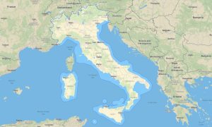
Discover Croatia’s Adriatic coastline, islands, karst mountains, historic cities, national parks, and inland plains with accurate Garmin maps for offline travel. This Garmin GPS map covers Zagreb, Split, Dubrovnik, Rijeka, Zadar, Istria, Dalmatia, Slavonia, Plitvice Lakes, and major ferry-connected areas.
Developed as an OSM map tourist Garmin resource, the map supports coastal drives, island exploration, sailing-access planning, hiking, cycling, campervan travel, and cultural routes. These outdoor maps Garmin travelers use include roads, paths, ferry terminals, beaches, rivers, viewpoints, and protected landscapes.
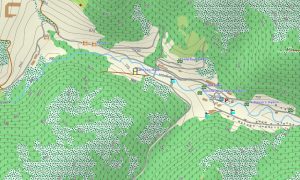
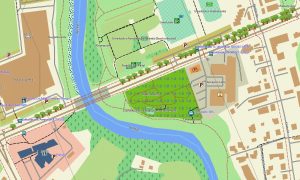
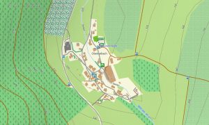
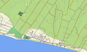
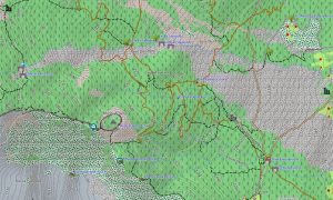
This Garmin GPS map serves as a detailed OSM topo map, displaying elevation contours, coastal cliffs, islands, mountain ridges, lakes, forest trails, rural tracks, and settlement layers. The Garmin map is valuable for both urban navigation and terrain assessment in karst regions like Velebit and Biokovo.
Created from open street maps Garmin compatible data, the product offers excellent detail for cities, national parks, islands, and rural roads. With an instant download Garmin map link, installation is fast, and updated Garmin OSM maps help maintain dependable navigation across the country.
Maps for Garmin navigator devices assist with driving along the Adriatic Highway, planning ferry approaches, exploring inland roads, and navigating tourist regions. A map for Garmin watch is useful for hikers, cyclists, runners, and travelers following coastal paths or island trails.
Key Features:
- Topographic maps for Garmin covering Croatia include roads, ferry links, tracks, hiking paths, rivers, lakes, islands, coastline, settlements, and elevation contours
- Natural features include the Adriatic coast, Dalmatian islands, Dinaric Alps, Plitvice Lakes, Krka waterfalls, karst plateaus, forests, beaches, and river valleys
- Road coverage includes motorways, regional roads, island roads, coastal highways, urban streets, rural lanes, mountain routes, tunnels, and border connections
- Points of interest include historic old towns, UNESCO sites, castles, churches, beaches, marinas, viewpoints, lighthouses, national parks, campsites, and ferry ports
- Routing support helps compatible maps for Garmin navigator devices guide drivers, cyclists, and tourists through mainland, coastal, and island routes
- Full compatibility is available for handheld Garmin GPS units, automotive devices, outdoor navigators, and supported models using a map for Garmin watch with OSM topographic maps
Only logged in customers who have purchased this product may leave a review.


Reviews
There are no reviews yet.