


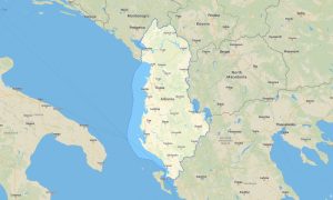
Greece Garmin topographic map
$32
Greece topo map for Garmin
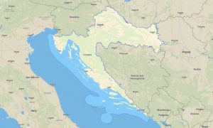
Explore Greece’s islands, mountains, archaeological sites, coastal roads, and historic cities with detailed Garmin maps built for offline navigation. This Garmin GPS map covers Athens, Thessaloniki, Crete, Peloponnese, Cyclades, Ionian Islands, Rhodes, mountain regions, ferry ports and rural villages.
Designed as an OSM map tourist Garmin resource, the map is ideal for island hopping, hiking, rental-car journeys, cultural tours, cycling, and coastal exploration. These outdoor maps Garmin travelers rely on include roads, footpaths, ferry links, beaches, harbors, rivers, gorges, and heritage locations.
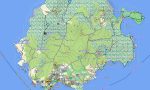
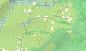
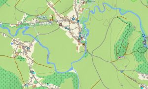
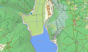
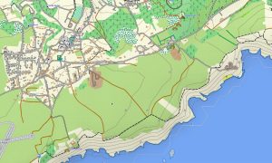
This Garmin GPS map functions as a practical OSM topo map, showing elevation contours, mountain ridges, valleys, islands, coastlines, tracks, and local paths. The Garmin map is especially useful in Crete, Olympus, Zagori, Peloponnese, and island interiors where terrain can change quickly.
Using open street maps Garmin compatible data, the product provides rich detail for urban areas, mountain villages, and island road networks. After purchase, users can download Garmin map files instantly, while updated Garmin OSM maps improve accuracy for routes, ferry access, and points of interest.
Maps for Garmin navigator devices help with road trips, scooter routes, ferry approaches, mountain drives, and navigation between beaches, ruins, and villages. A map for Garmin watch supports hikers, runners, and cyclists following coastal trails, ancient paths, or mountain routes.
Key Features:
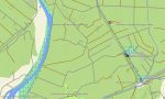
- Topographic maps for Garmin covering Greece include roads, tracks, trails, ferry links, rivers, coastlines, islands, beaches, settlements, and elevation contours
- Natural features include Mount Olympus, Aegean islands, Ionian coast, Cretan gorges, Peloponnesian mountains, beaches, forests, valleys, and rocky headlands
- Road coverage includes motorways, regional roads, village streets, mountain roads, island routes, coastal roads, ferry terminals, and rural tracks
- Points of interest include archaeological sites, monasteries, castles, harbors, beaches, viewpoints, museums, ancient theaters, lighthouses, campsites, and old towns
- Routing support allows compatible maps for Garmin navigator devices to guide travelers through mainland roads, island networks, and tourist regions
- Full compatibility is available for handheld GPS units, automotive Garmin devices, outdoor navigators, and supported devices using a map for Garmin watch with OSM topographic maps
- The map is presented in two versions: with captions in Latin and in Greek
Only logged in customers who have purchased this product may leave a review.


Reviews
There are no reviews yet.