


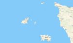


Guernsey and Jersey Garmin topographic map
$22
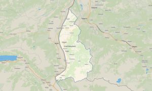
Guernsey and Jersey topo map for Garmin
The map brings island navigation, coastal detail, and terrain awareness together for offline travel. This Garmin maps product is designed for the Channel Islands, covering St Helier, St Peter Port, small parishes, ferry areas, beaches, gardens, cliff paths, rural lanes, and historic waterfronts for holidays, business trips, and weekend escapes.
Built for drivers, walkers, cyclists, and short-stay visitors, the Garmin GPS map helps users find routes between airports, ports, village centers, viewpoints, campsites, and hotel districts. It works without mobile data, which is useful on coastal roads, sheltered bays, busy town streets, in every travel season, wind or fog.
Use the Garmin map for rental car journeys around Jersey or Guernsey, from lighthouse stops to sandy coves and museum visits. As an OSM map tourist Garmin option, it supports sightseeing plans, walking loops, cycle detours, food stops, and direct access to local points of interest with better offline confidence.
Unlike basic road files, these outdoor maps Garmin users rely on include paths, steps, footbridges, parks, fields, reservoirs, sea walls, viewpoints, and terrain features. A second Garmin GPS map advantage is clarity when narrow lanes, one-way systems, and tidal access points make navigation demanding throughout the day.
The cartography is prepared from open street maps Garmin compatible data, offering frequent improvements from local mapping sources. After purchase, travelers can download Garmin map files quickly, install them before departure, and use updated Garmin OSM maps across both islands during independent exploration with simple device preparation.
Maps for Garmin navigator devices are practical for port transfers, airport arrivals, coastal circuits, and scenic drives between beaches and parish villages. They also help drivers avoid missed turns in compact towns where roundabouts, restricted streets, and parking entrances can appear close together and evening restaurant trips.
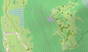
For active travel, a map for Garmin watch gives convenient wrist-based guidance while running seaside promenades or following cliff-top trails. The OSM topo map and OSM topographic maps display contours and landscape structure, helping users understand slopes, headlands, valleys, and coastal access before starting each route.
Key Features:
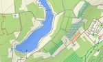
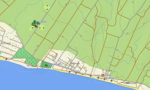
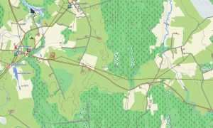
- Topographic maps for Garmin cover Guernsey and Jersey with roads, lanes, coastal paths, elevation contours, cliffs, beaches, harbors, villages, parks, fields, reservoirs, and detailed shoreline references
- Natural content includes St Ouen’s Bay, St Brelade’s Bay, La Corbière, St Peter Port, Cobo Bay, Pleinmont, wooded valleys, headlands, tidal flats, coves, and scenic viewpoints
- Road data shows urban streets, parish roads, narrow green lanes, airport links, ferry terminal access, parking areas, cycle routes, residential approaches, and rural tracks for practical routing
- Points of interest identify forts, castles, museums, churches, hotels, restaurants, markets, bus stops, fuel stations, marinas, campsites, hospitals, beaches, gardens, lighthouses, and visitor services
- Routing support helps compatible maps for Garmin navigator devices plan beach drives, town transfers, cycling loops, walking routes, harbor connections, and short cross-island sightseeing journeys
- The map supports handheld units, vehicle devices, cycling computers, and supported watches, giving offline OSM topographic maps for visitors exploring compact islands where roaming coverage, tides, and confusing lanes may interrupt navigation
Only logged in customers who have purchased this product may leave a review.

Reviews
There are no reviews yet.