


Luxembourg Garmin topographic map
$22
Luxembourg topo map for Garmin
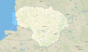
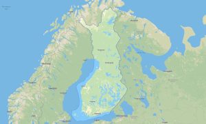
Discover Luxembourg’s compact mix of historic towns, forested hills, river valleys, castles, and cross-border roads with accurate Garmin maps for offline navigation. This Garmin GPS map covers Luxembourg City, Esch-sur-Alzette, Echternach, Vianden, the Moselle Valley, Mullerthal, Ardennes foothills, and rural communities.
Created as an efficient OSM map tourist Garmin solution, the map supports hiking, cycling, commuting, road trips, cultural routes, and weekend outdoor travel. These outdoor maps Garmin users rely on include streets, forest paths, rivers, tracks, viewpoints, vineyards, villages, and tourist landmarks.
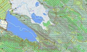
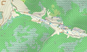
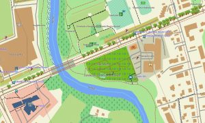
This Garmin GPS map works as a detailed OSM topo map, showing elevation contours, valleys, wooded slopes, river corridors, local trails, rural lanes, and urban layers. The Garmin map is especially useful in the Mullerthal region, Moselle wine country, and northern hills where terrain changes quickly.
Using open street maps Garmin compatible data, the product provides excellent detail in a small but highly connected country. After purchase, users receive an instant download Garmin map link, and Garmin OSM maps updates help keep roads, paths, and points of interest reliable.
Maps for Garmin navigator devices are suitable for city driving, cross-border travel, cycling routes, and navigation between castles, villages, trails, and scenic areas. A map for Garmin watch supports runners, hikers, cyclists, and walkers on forest paths and urban routes.
Key Features:
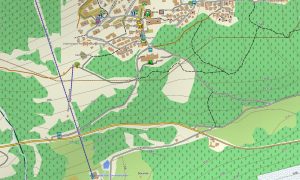
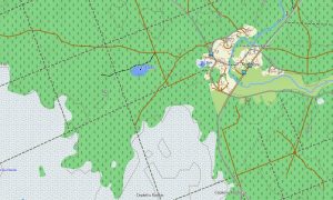
- Topographic maps for Garmin covering Luxembourg include roads, tracks, hiking paths, cycleways, rivers, forests, villages, towns, vineyards, and elevation contours
- Natural features include Mullerthal sandstone formations, Moselle Valley, Ardennes hills, forests, river valleys, meadows, gorges, and scenic viewpoints
- Road coverage includes motorways, national roads, local streets, rural lanes, forest roads, cycling routes, bridges, tunnels, and border connections
- Points of interest include castles, old towns, museums, churches, vineyards, viewpoints, campsites, trailheads, monuments, parks, and cultural sites
- Routing support helps compatible maps for Garmin navigator devices guide city trips, rural routes, cycling tours, and international travel
- Full compatibility is available for handheld Garmin GPS units, automotive navigators, outdoor devices, and supported models using a map for Garmin watch with OSM topographic maps
Only logged in customers who have purchased this product may leave a review.


Reviews
There are no reviews yet.