


Hungary Garmin topographic map
$29
Hungary topo map for Garmin
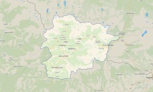
Discover Hungary’s plains, lakes, river valleys, thermal towns, historic cities, and cycling routes with reliable Garmin maps for offline navigation. This Garmin GPS map covers Budapest, Debrecen, Szeged, Pécs, Lake Balaton, the Danube Bend, Hortobágy, wine regions, and rural road networks.
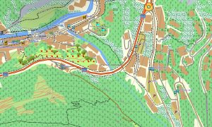
Built as an OSM map tourist Garmin solution, the map supports road trips, bike touring, city sightseeing, spa travel, hiking in uplands, and countryside exploration. These outdoor maps Garmin users depend on include roads, paths, rivers, lakes, villages, parks, viewpoints, and tourism infrastructure.
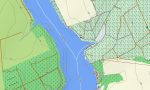
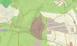
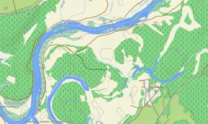
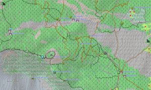
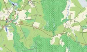
This Garmin GPS map works as an OSM topo map with elevation contours, low mountains, plains, riverbanks, reservoirs, forest tracks, and settlement details. The Garmin map is useful for planning routes around Lake Balaton, the Bükk Mountains, Mátra, Danube landscapes, and national parks.
Based on open street maps Garmin compatible data, the product provides clear coverage for urban streets, rural lanes, and outdoor areas. Users receive an instant download Garmin map link for quick setup, and Garmin OSM maps updates help keep navigation data reliable over time.
Maps for Garmin navigator devices support driving, cycling, camper routes, city travel, and access to vineyards, spas, lakes, and protected areas. A map for Garmin watch is convenient for runners, hikers, cyclists, and walkers exploring urban parks or countryside trails.
Key Features:
- Topographic maps for Garmin covering Hungary include roads, tracks, cycleways, trails, rivers, lakes, wetlands, forests, towns, villages, and elevation contours
- Natural features include Lake Balaton, Danube River, Tisza River, Great Hungarian Plain, Bükk Mountains, Mátra hills, wetlands, forests, and grasslands
- Road coverage includes motorways, national roads, regional roads, city streets, rural lanes, cycling routes, bridges, border crossings, and lake access roads
- Points of interest include thermal spas, castles, vineyards, historic centers, museums, viewpoints, campsites, national parks, monasteries, monuments, and ferry points
- Routing support helps compatible maps for Garmin navigator devices guide travelers through cities, plains, lake districts, and cross-border corridors
- Full compatibility supports handheld Garmin GPS units, automotive devices, cycling computers, and selected models using a map for Garmin watch with OSM topographic maps
Only logged in customers who have purchased this product may leave a review.
Reviews
There are no reviews yet.