


Ireland and Northern Ireland Garmin topographic map
$36
Ireland and Northern Ireland topo map for Garmin
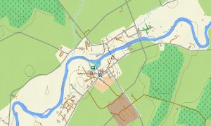
Explore the entire island with detailed Garmin maps created for the Republic of Ireland and Northern Ireland, from Atlantic peninsulas to Belfast streets. This Garmin GPS map gives dependable offline guidance across Dublin, Cork, Galway, Limerick, Derry, coastal villages, national parks, and rural mountain passes.
Designed as a flexible Garmin map for travel planning, it supports road touring, hiking, cycling, motorhome routes, fishing trips, and heritage exploration. You can navigate quiet lanes, ferry approaches, greenways, forest roads, hill trails, and busy urban districts without relying on mobile coverage.
As an OSM map tourist Garmin solution, the dataset includes attractions, viewpoints, accommodation areas, campsites, museums, harbours, beaches, castles, and local services. It helps independent visitors connect the Wild Atlantic Way, Causeway Coastal Route, Ring of Kerry, Wicklow Way, and many cross-border itineraries.
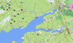
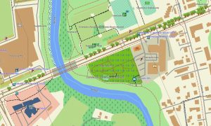
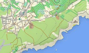
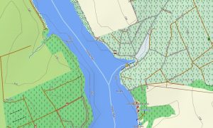
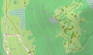
These outdoor maps Garmin users choose show terrain references essential for open countryside and rugged coastlines. Contours, streams, lakes, bogs, woodland, cliffs, beaches, minor tracks, and access paths make route assessment easier in Connemara, Donegal, the Mournes, Antrim, Kerry, and Wicklow.
This Garmin GPS map also works as an OSM topo map for walkers who need elevation awareness on long-distance paths. The OSM topographic maps display uplands, valleys, river corridors, reservoirs, islands, and coastal relief, giving clear context for outdoor navigation and scenic touring.
Built from open street maps Garmin compatible data, coverage is regularly refreshed to reflect roads, paths, and points of interest. After purchase, an instant download Garmin map link lets you install quickly, while Garmin OSM maps keep the package practical for repeat visits.
Maps for Garmin navigator devices are suitable for self-drive holidays, motorcycle journeys, delivery planning, and rural detours across both jurisdictions. A map for Garmin watch is equally useful for runners, hikers, and cyclists following greenways, coastal paths, park loops, canal routes, and mountain trails. It complements topographic maps for Garmin navigation outdoors.
Key Features:
- Topographic maps for Garmin cover the Republic of Ireland and Northern Ireland with motorways, regional roads, lanes, ferry links, footpaths, cycleways, contours, rivers, lakes, forests, beaches, settlements, and coastal details
- Terrain content highlights Wicklow, Connemara, Kerry, Donegal, Mourne Mountains, Antrim Coast, Giant’s Causeway, Lough Neagh, the Shannon system, peat bogs, cliffs, islands, valleys, and upland passes
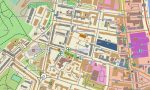
- Road and trail data supports Dublin, Belfast, Cork, Galway, Limerick, Derry, Waterford, towns, villages, rural access roads, greenways, forest tracks, national parks, and cross-border journeys
- Tourist points include castles, abbeys, museums, harbours, viewpoints, campsites, beaches, golf areas, railway stations, bus stops, fuel stations, pubs, visitor centres, trailheads, and heritage sites
- Routing on compatible maps for Garmin navigator devices helps drivers, cyclists, walkers, and motorhome travellers plan offline routes through cities, peninsulas, islands, rural lanes, and scenic coastal roads
- These Garmin OSM maps install on many handheld GPS units, car navigators, outdoor receivers, and supported wearables requiring a dependable map for Garmin watch adventures daily
Only logged in customers who have purchased this product may leave a review.


Reviews
There are no reviews yet.