


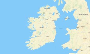
Isle of Man Garmin topographic map
$22
Isle of Man topo map for Garmin
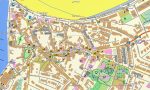
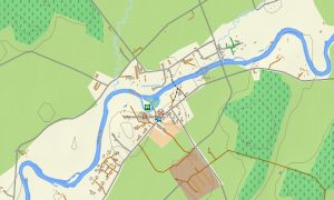
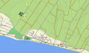
Explore the Isle of Man with detailed Garmin maps created for a compact island of dramatic coastlines, hill roads, glens, beaches, ports, and historic villages. This Garmin GPS map supports offline navigation around Douglas, Peel, Ramsey, Castletown, Port Erin, Laxey, Snaefell, coastal lanes, and rural parishes where mobile signal can vary.
Built as a practical Garmin map for visitors and residents, it helps plan sightseeing drives, walking weekends, cycling loops, motorcycle touring, and ferry-linked journeys. The OSM map tourist Garmin format combines roads, footpaths, attractions, viewpoints, accommodation areas, cafés, beaches, harbours, museums, and service points for independent travel.
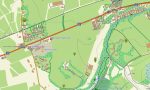
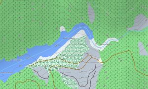
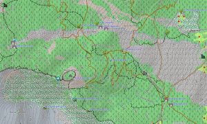
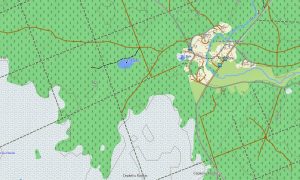
These outdoor maps Garmin users rely on are especially useful beyond the main towns, where narrow lanes quickly meet open moorland and cliff scenery. Tracks, bridleways, woodland paths, streams, reservoirs, coastal access points, and parish boundaries help hikers, runners, cyclists, and geocachers understand the island’s changing terrain.
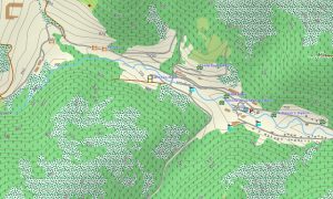
As a Garmin GPS map with OSM topo map detail, it displays elevation contours for Snaefell, South Barrule, North Barrule, Slieau Freoaghane, and surrounding valleys. The OSM topographic maps make it easier to judge climbs, descents, exposed ridges, coastal steps, plantation trails, and scenic viewpoints before starting a route.
Created from open street maps Garmin compatible data, the package gives clear coverage for urban streets, rural roads, public paths, and points of interest across the Crown Dependency. After ordering, an instant download Garmin map link provides quick installation, while updated Garmin OSM maps keep navigation practical for repeat island trips.
Maps for Garmin navigator devices suit drivers following the TT course, campers visiting glens, and walkers linking heritage railways with coastal paths. A map for Garmin watch adds convenient wrist guidance for trail running, cycling, hillwalking, dog walks, and short outings from villages or ferry terminals throughout the island in every season safely.
Key Features:
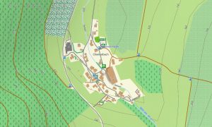
- Topographic maps for Garmin cover the Isle of Man with primary roads, minor lanes, footpaths, cycle routes, contours, rivers, reservoirs, beaches, cliffs, ports, villages, plantations, and detailed coastline information
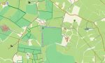
- Natural coverage includes Snaefell, the Calf of Man, Glen Maye, Dhoon Glen, Ayres dunes, marine viewpoints, upland moors, wooded valleys, headlands, bays, and scenic coastal tracks
- Road data supports Douglas, Peel, Ramsey, Castletown, Laxey, Port Erin, Port St Mary, ferry approaches, rural parishes, TT Mountain Course sections, and quiet back-road exploration
- Points of interest include castles, heritage railways, tram stops, lighthouses, beaches, campsites, museums, churches, pubs, fuel stations, car parks, viewpoints, trailheads, picnic sites, and visitor facilities
- Routing on compatible maps for Garmin navigator devices helps motorists, cyclists, motorcyclists, hikers, and walkers plan offline journeys between harbour towns, glens, hill roads, plantations, and coastal attractions
- These Garmin OSM maps work with handheld GPS units, car devices, outdoor receivers, and supported wearables using a map for Garmin watch with OSM topographic maps
Only logged in customers who have purchased this product may leave a review.


Reviews
There are no reviews yet.