


Norway Garmin topographic map
$32
Norway topo map for Garmin
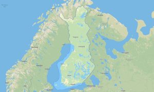
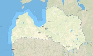
Navigate Norway’s fjords, mountains, Arctic roads, islands, forests, and coastal communities with advanced Garmin maps prepared for offline travel. This Garmin GPS map covers Oslo, Bergen, Trondheim, Stavanger, Tromsø, Lofoten, Nordland, the fjord region, national parks, and remote northern routes.
Designed as an OSM map tourist Garmin resource, the map is ideal for road trips, hiking, cycling, ski touring, campervan journeys, fishing access, and wilderness exploration. These outdoor maps Garmin adventurers rely on include roads, trails, ferries, rivers, lakes, mountain huts, viewpoints, and natural landmarks.
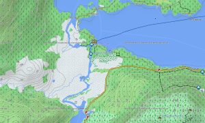
This Garmin GPS map functions as a precise OSM topo map, showing elevation contours, glaciers, valleys, fjords, ridgelines, plateaus, forests, and coastal terrain. The Garmin map is especially valuable in Jotunheimen, Hardangervidda, Lofoten, Senja, and Arctic Norway, where terrain and weather require careful planning.
Using open street maps Garmin compatible data, the product delivers detailed information for cities, scenic roads, ferry networks, and remote areas. Users receive an instant download Garmin map link for fast installation, and Garmin OSM maps updates help keep routes and points of interest reliable.
Maps for Garmin navigator devices support long-distance driving, ferry-connected routes, mountain access, and travel between villages, trailheads, and viewpoints. A map for Garmin watch helps hikers, runners, skiers, and cyclists follow routes in demanding outdoor environments.
Key Features:
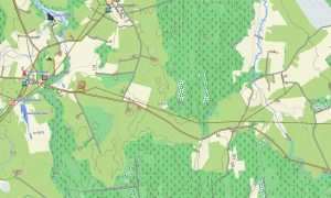
- Topographic maps for Garmin covering Norway include roads, tracks, hiking trails, ferries, rivers, lakes, fjords, glaciers, settlements, and elevation contours
- Natural features include fjords, mountains, glaciers, Arctic tundra, forests, islands, waterfalls, plateaus, valleys, coastal cliffs, and northern wilderness areas
- Road coverage includes national roads, scenic routes, tunnels, bridges, ferry approaches, city streets, rural roads, mountain roads, and remote northern corridors
- Points of interest include mountain huts, viewpoints, lighthouses, harbors, ski areas, museums, campsites, national parks, waterfalls, and historic sites
- Routing support allows compatible maps for Garmin navigator devices to guide road trips, ferry connections, mountain access, and rural travel
- Full compatibility supports handheld Garmin GPS units, automotive devices, outdoor navigators, and selected devices using a map for Garmin watch with OSM topographic maps
Only logged in customers who have purchased this product may leave a review.


Reviews
There are no reviews yet.